How Remote Sensing Helps Public Archaeology
 Wednesday, August 11, 10:30-11:30
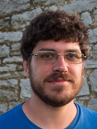
As Belle Grove Plantation researchers have investigated the enslaved quarter site on the property, they have used traditional methods of archaeology. This talk will discuss how adding remote sensing (Ground Penetrating Radar and Light Detection and Ranging or LIDAR) for 3D mapping can help them potentially find foundations and roads that would otherwise be difficult or time consuming to detect. We welcome the lead archaeologist Matthew Greer (pictured here) and the archeology team to tell us more about these techniques.
Join us on for this free talk that will be in-person on the lower level of the Manor House (check in at the Welcome Center first) and online (register in advance here and the Zoom link will be sent to you before the event).


